Tuesday, May 4, 2021

The Chicago Women's Park and Gardens - Part III

In Part I of our series, we looked at the early history of the site now occupied by the Women’s Park, including the houses that originally stood there. In Part II, we examined the various proposals created through the years to transform the four-acre parcel of land south of Glessner House into a site to exhibit architectural fragments and interpret Chicago history. Part III, the final installment in the series, starts in the mid-1990s, when the redevelopment of the surrounding area into a desirable residential neighborhood at long last brought the park plans to fruition.

1996 – National Vietnam Veterans Art Museum


In 1981, an organization known as the Vietnam Veterans Art Group was formed with the purpose of providing exhibition opportunities for veterans of the Vietnam War and those impacted by the conflict. The exhibition toured the U.S. for many years, and in 1995 returned to Chicago, settling into a temporary space in the Prairie District Lofts at 1727 S. Indiana Avenue.
 

The following year, the City of Chicago donated the former Swiss Products buildings at 1801 S. Indiana Avenue to the Group, along with $1,000,000 to renovate the structure, which had sat largely vacant for twenty years. The National Vietnam Veterans Art Museum opened by mid-summer, combining permanent pieces with temporary exhibitions. A noteworthy permanent installation, entitled “Above and Beyond,” was unveiled in 2001 above the central atrium and consisted of 58,226 dog tags representing every American casualty in the War.


The Museum struggled financially and by 2007 rumors spread that it was planning to sell the building, possibly for reuse as a nightclub. The City, with its significant investment intervened, and in time operations stabilized. In 2012, by which time the museum had been renamed the National Veterans Art Museum (to include work by veterans of all wars), it was announced that it would be moving out of the building and relocating to 4041 N. Milwaukee Avenue in the Portage Park neighborhood. At that time, the entire building was turned over for use as the park fieldhouse.

(NOTE: Café V opened in a ground floor space of the building in July 1997. It was replaced by Café Society in 2001 which operated until 2015, when Spoke & Bird opened in the space.)

1997 – A New Park for Prairie Avenue: Growing with a Community for the Future
In April 1997, several city officials including Mayor Daley’s Chief of Staff, Terry Teele, toured the Glessner and Clarke Houses, and surrounding Prairie Avenue Historic District. As a result of that visit, Prairie Avenue House Museums (the name under which the two houses were operating at the time), engaged the City Design Center of the College of Architecture and the Arts at the University of Illinois at Chicago to prepare a comprehensive plan for what was then known simply as Prairie Avenue Park, to make it “the center of life and activity for a newly invigorated Near South Side.”


The goals of the plan were to provide greenspace for new residents moving into the area, broaden the appeal and access of the park and the Historic District, and to maximize public resources through creative local collaborations. The price tag to implement the plan was $1.4 million with several key elements quite different from the park as ultimately built. The Prairie Avenue side of the park, accessed by six entrances, was to feature an athletic field, seating niches, and the historic footprints of the lost houses. On Indiana Avenue, the main feature was a stage with theater seating, a ticketing kiosk, and restrooms.

October 1997 – The Hillary Rodham Clinton Park is dedicated
Although the park was ultimately not built according to the plan, sufficient interest had been generated to proceed with next steps. Lois Weisberg, Commissioner of the Chicago Department of Cultural Affairs, developed the idea to name the park in honor of First Lady Hillary Rodham Clinton, who would be coming to Chicago in October to celebrate her 50th birthday (having been born and raised in Chicago and Park Ridge).

Plans were quickly put into place, including the removal of the controversial monument to the Battle of Fort Dearborn, which had been standing in the park for a decade. Just five days before the park dedication, the statue was removed and put into storage, where it remains to this date. (NOTE: The statue, traditionally known as the Fort Dearborn Massacre Statue, was recently identified as one of 41 statues to be reviewed by the Chicago Monuments Project. Its website notes that it was “conceived in a sensationalist, luridly violent mode (and) was long criticized by American Indian activists.”)


Dedication of the Hillary Rodham Clinton Women’s Park of Chicago took place on October 27, 1997, one day after Clinton’s birthday, and was part of a day-long “extravaganza” of events around the city in her honor. The hour-long ceremony commenced at 1:30pm and included classical and jazz music performed by the Avalon String Quartet and Samara, and remarks by Mayor Richard M. Daley, Maggie Daley, and Lois Weisberg. After Clinton spoke, she presented bulbs for the pink Hillary Rodham Clinton tulip, removed from the White House gardens. Open house tours of the Glessner and Clarke Houses followed the ceremony, and Clinton was presented with a copy of the book about Glessner House authored by Elaine Harrington. In a thank you note sent afterwards, Clinton noted, “It was a day I will treasure always, and one so special it could have happened only in Chicago.”


By this point, the concept plan for the park had been significantly reworked from that developed just a few months earlier, eliminating the athletic field, stage and seating, and house footprints, instead focusing the design completely on landscaping. New features included a central rose garden (a nod to the famous rose garden at the White House), and the incorporation of the historic coach house behind the Keith House at 1900 S. Prairie Avenue, to serve as a venue for art exhibits and educational activities.

First Lady Hillary Clinton with Glessner House Program Director Micki Leventhal

A 36-member Women’s Advisory Committee was appointed to continue work on the design and interpretation of the park. Local representatives included Marcy and Traci Baim (owners of the Keith House), and Micki Leventhal, Program Director at Glessner House.

2000 – The Park begins to take shape
Mayor Richard M. Daley’s interest in gardening and significant landscaping initiative, known as the Great Gardens Program, were key factors in making the park a reality. His administration instituted the planting of trees and median strips, and the greening of the roof on City Hall, so it was no surprise when he pushed for the completion of the park, located just a few blocks south of his Indiana Avenue townhouse.


Landscape architect Mimi McKay noted that “this is a small landscape on a human scale. The buildings surrounding it contribute a more gardenlike feeling, reminiscent of a home setting; and unlike the more formal Chicago parks, the Women’s Park is extremely plant intensive, and that is what makes it so distinctive.” The design was sensitive to Clarke House, which had been moved to the park in 1977. To the north, a meadow paid homage to the original open prairie; to the south, plans for heirloom vegetable gardens were instead revised to provide plots for residents to cultivate their own vegetables, in the spirit of the Clarke family.

Tannys Langdon, the project architect, noted the overall character of the park. “We are making places here, not objects that decorate the space.” A key feature of the design is the curvilinear path around the park perimeter, created as a metaphor representing a woman’s movement in and out of traditional roles over a lifetime. (Plans to install 400 plaques in the sidewalk with the names of women who made significant contributions to Chicago’s history were never realized. The women and their achievements, however, are recorded in the biographical dictionary, Women Building Chicago, 1790-1990, edited by Rima Schultz and Adele Hast.)


To offset the winding path, a quiet and contemplative central fountain, set within a garden room enclosed with raised brick beds, was created to represent domestic achievement and “the thousands of small, homely acts that provide a steady center to so many lives.” Gravel paths were carefully arranged to provide easy navigation of the park and were lined with paver bricks repurposed from the alley that originally bisected the park. A small open-air summerhouse was envisioned for the northeast corner of the park, but only the base was ever constructed.


2002 – What is the name of the park??


Work on the park was completed during 2000 and 2001. But by early 2002, visitors noted that the signs with Clinton’s name had been removed, and the City was referring to it simply as the Women’s Park. When pressed on the issue, a city official noted that the name was “up in the air.” Approximately $500,000 of the $2.175 million cost was needed to finish the project, and the city was considering naming opportunities to raise the remaining funds. It was also noted that the Chicago Park District had a rule in place forbidding the naming of parks after living individuals – however, this park was owned and managed by the City, not the Park District. Rumors circulated that a rift between the Daleys and Clintons had brought about the removal of the name. Eventually the name Chicago Women’s Park and Gardens of Chicago was officially adopted.

2003-2004 – A playhouse, birdhouses, and interpretive panels


During the Taste of Chicago in 2003, three children’s playhouses were created and put on display; at the end of the Taste, they were auctioned off to benefit HomeAid Chicago. The three houses were designed to represent a typical Chicago bungalow, a Victorian house, and the Clarke House. Greg Thomas of McClier Architects designed the structures, and they were fabricated by Summit Homes. The Clarke House playhouse found its way to the Women’s Park where it was installed immediately to the south of the real Clarke House. It was greatly enjoyed by children for more than a decade, but its deteriorated condition resulted in its demolition in August 2014.


TOP: "For Wild Birds Only" by Teresa Kier
BOTTOM: "Chicago Cultural Center" by Department of Cultural Affairs Tourism Volunteers

In 2004, the City of Chicago hosted an exhibit in the park entitled “For the Birds: an amazing exhibition of birdhouse dwellings by Chicago artists and architects.” A total of 67 birdhouses were created by artists, architects, and designers, and were placed throughout the park and inside Clarke House. The exhibit ran from June 15 through October 15, 2004, and a special commemorative booklet was produced with a photo of each piece of “functional art” noting the title and artist. At the end of the exhibit, the birdhouses were auctioned off, although one remains in the park to this day.


That same year, the decision was made to replace the interpretive panels along the Prairie Avenue side of the park, which were showing their age after having been in place more than 20 years. Rather than focus on panels that each discussed one specific house, the new panels gave a more comprehensive history of Prairie Avenue. Four panels showed the prominent lost houses, and four additional panels provided a timeline from 1812 through the present day. Two panels discussed the interiors of the houses and the role of servants in operating them, and the final two panels gave an overview of the surviving historic structures on and around Prairie Avenue.

2005 and 2008 – Memorial trees
SHERRY GOODMAN
In May 2005, long-time community and non-profit servant, and public broadcasting pioneer Sherry Goodman died at the age of 78. During the 1960s and 1970s she worked for WTTW, starting as a freelance producer, and working her way up to producer and director of special audiences. She left to spearhead plans for the 50th anniversary of the Museum of Science and Industry in 1983, and later served as founding president and chief executive of Chicago Access Corp., organized to administer public-access TV channels.

Goodman was also a member of the Roslyn Group, a literary salon which had been formed in 1977 at the home of a member who lived on Roslyn Place. The group read Judy Chicago’s Through the Flower: My Struggle as a Woman Artist telling of her exhibition “The Dinner Party,” that challenged the myth surrounding and narrowly defining women’s experience. The group was committed to finding a Chicago venue for "The Dinner Party" after learning that the Art Institute turned it down. When traditional approaches failed, the Group incorporated as The Roslyn Group for Arts and Letters to host the exhibition themselves in 1981. Goodman served as director of special audiences.


After her death in 2005, the Roslyn Group planted a tree in her honor south of the community garden plots, marked by a small plaque.

INTERNATIONAL WOMEN ASSOCIATES
On October 1, 2003, twenty members of the International Women Associates spent the day visiting the Anderson Gardens, a 12-acre Japanese garden in Rockford. The Associates is a Chicago cultural and educational organization whose members engage in cross-cultural exchange, cultural service, dialogue, and friendship to foster a more just and peaceful world. The tour bus was heading back to Chicago at 3:00pm when it was rear-ended by a semi-truck, killing eight members of the group.


To commemorate the fifth anniversary of the accident in October 2008, IWA members gathered in the Women’s Park to dedicate two trees flanking the entrance into the park from Prairie Avenue. A plaque beside one of the trees notes “In memory of our eight friends, we will never forget you.”

2011 – Helping Hands


In 2009, the City of Chicago transferred ownership of the park to the Chicago Park District. Two years later, the Park District selected the Women’s Park as the new site for its sculpture, Helping Hands, sculpted in 1993 by Louise Bourgeois (1911-2010) to honor Jane Addams. The sculpture was financed by the B. F. Ferguson Fund of the Art Institute and was installed in 1996 in Navy Pier Park. The sculpture consists of six roughly hewn granite pedestals, each supporting beautifully sculpted and polished hands symbolizing the many different people helped by Jane Addams and Hull-House through the years. The six pedestals represented Addams as social philosopher, pragmatist, writer, lecturer, defender, and the first significant woman to have a major work of art installed in a Chicago park.

By 2006, the sculpture had been vandalized, and it was shipped to New York where Bourgeois recarved the damaged sections. On September 24, 2011, it was rededicated in its new location in the Women’s Park, immediately north of Clarke House. Dignitaries from the city and Park District were present, and Betsey Means appeared as Jane Addams to give a moving speech in Addams own words discussing her work and impact on the immigrant communities served by Hull-House.


Betsey Means as Jane Addams

In 2015, Helping Hands was selected for inclusion in “Statue Stories,” a collaboration between the Richard H. Driehaus Foundation and the Chicago Park District, whereby people could use their mobile phone to scan a QR code and then listen to the story of the statue. The text for Helping Hands was written by author Blue Bailliett and was recorded by actress and Oak Park native Amy Morton. Click here to listen.


2017 – Famous Chicago Women


Chicago Park District historian Julia Bacharach at podium
Alderman Pat Dowell standing at far right

The long-anticipated plan to honor important Chicago women at the park became a reality in 2017. Alderman Pat Dowell, the Chicago Park District, and the Chicago Women’s Park Advisory Council collaborated on the permanent installation of “Famous Chicago Women” in the lobby of the fieldhouse, dedicated on September 14, 2017. The women selected come from all walks of life and include leaders, activists, visionaries, artists, trailblazers, and innovators. Names include Ida B. Wells-Barnett, Guadalupe Reyes, Gwendolyn Brooks, Harriet Monroe, Lorrain Hansberry, Pearl Hart, Margaret Hie Ding Lin, Lois Weisberg, and Frances Glessner Lee. Panels featuring portraits of selected women face the second-floor mezzanine in the lobby, and the names of all others are inscribed on the wall. Ten women are also featured in a large window display facing Indiana Avenue.
Click here to download a brochure describing all the women honored in the exhibit.


Conclusion
This concludes our look at the decades of dreaming, planning, and implementation by countless individuals which resulted in the neighborhood treasure we enjoy today – the Chicago Women’s Park and Gardens of Chicago. The next time you visit Prairie Avenue, Glessner House, or Clarke House, we hope you will spend some time in the park enjoying its natural beauty and learning more about the significant women it honors.

Tuesday, April 6, 2021

The Chicago Women's Park and Gardens - Part II

In Part I of our series, we looked at the prehistory of the present site of the Chicago Women’s Park and Gardens including the houses that stood there and the difference in development between Prairie and Indiana Avenues. A series of photos taken by Richard Nickel in the late 1960s captured the decline the neighborhood had experienced throughout much of the 20th century. In this installment, we will explore the period from 1968 until the early 1990s, when various proposals were developed to convert this grouping of vacant lots and parking lots into a park that would serve as a source of pride and an asset to the surrounding community.

Origins

As Marian Despres noted in her book, The First Twenty Years 1966-1986, “the creation of a park memorializing an important part of Chicago’s history in the midst of a rubble-strewn, long-deserted neighborhood was a great event.” Although she used the term “park” to describe the Prairie Avenue Historic District as a whole, the land comprising the present Women’s Park was always an essential part of the discussion. Within two years of saving Glessner House in 1966, the houses immediately to the south, at 1808 and 1812 S. Prairie, and the house across the street, at 1815 S. Prairie, had all been razed. This prompted a realization of the need to protect and preserve the historic resources that remained and to find a new use for the large swath of open land south of Glessner House.


1800 block of Prairie Avenue looking south, 1975

Planning

Planning funds were received in 1972 from the Chicago Community Trust and the National Endowment for the Arts to hire two nationally recognized planning experts. Roy Graham led the planning for Colonial Williamsburg, and James Marston Fitch was the founder and director of the historic preservation program at Columbia University. Regarding Fitch’s report, Despres noted:

“He recommended restoring and moving in other old buildings, some to be occupied to keep the area alive 24 hours a day. He suggested that developers working in areas where there were fine or significant old buildings be encouraged to move them to the District; they would save demolition costs and the donation of a house to the District could bring a tax benefit.”

The idea to move Clarke House into the area was a direct outgrowth of Fitch’s report; it was ultimately the only building moved to Prairie Avenue. Fitch also suggested the display of architectural fragments – larger pieces in an outdoor park, and smaller and more fragile pieces in the Swiss Products building at 1801 S. Indiana Avenue (the present fieldhouse). This recommendation addressed another issue - a growing collection of architectural fragments was gathering at Glessner, many salvaged by Richard Nickel during the unchecked demolition in the 1950s and 1960s of significant buildings by Adler & Sullivan, Burnham & Root, Frank Lloyd Wright, and others.


South end of current park site, looking toward the Keith House coach house, 1974

Land Acquisition
By the summer of 1973, the Chicago City Council approved the acquisition of the first parcels of land that comprise the current park, utilizing forthcoming funds from a State of Illinois Open Lands grant, along with federal funds from the Department of Housing and Urban Development that would be released once the city provide a 1-to-3 match. Governor Dan Walker visited Glessner House in September 1974 to sign the Open Lands grant agreement that provided a total of $350,000 in state funding for the project.


(L-R) Ruth Moore Garbe, Governor Walker, Marian Despres

In December of that year, Richard Macias of Preservation Urban Design was engaged to create the master plan for the Prairie Avenue streetscape, the park site, and the Swiss Products building. When Macias presented his plan in July 1975, proposed elements of the park included “footsteps” representing the original foundations of the lost houses on Prairie Avenue, and the division of the park into quadrants representing four distinct periods in the history of Chicago architecture. “The vacant land between the Glessner and Keith houses and part of the land surrounding the Clarke House site will become an architectural park where ornament, exhibits and demonstrations of Chicago architecture will be shown in a correct, handsome park setting.”

Clarke House

In 1977, the City of Chicago purchased the Clarke house from the St. Paul Church of God in Christ, which, under the leadership of Bishop Louis Henry Ford, had preserved the building for more than three decades. Plans were made to move the 120-ton structure nearly four miles from its site at 4526 S. Wabash Avenue to its new home on the Indiana Avenue side of the park.


Clarke House resting on Indiana Avenue, awaiting the move onto its new foundation (shown in the foreground), December 1977

The move in December 1977 attracted national attention, including the lifting of the building up and over the Green Line tracks at Calumet Avenue and 44th Street. (Click here to read an August 2014 blog article about the move). In 1978, The National Society of the Colonial Dames of America in the State of Illinois signed on as a partner to restore and furnish the interior of the house. It opened to the public in 1982.


Clarke House, circa 1980

Prairie Avenue Historic District Restored

The year 1978 saw major progress. The streetscape of the 1800 block of South Prairie Avenue was restored to its 1890s appearance as suggested by Fitch, including limestone sidewalks, period light fixtures, granite curbs, and cobblestone gutters. Several buildings that were determined too deteriorated to be restored were razed, including the three rowhouses that faced 18th Street immediately west of Glessner House, and two surviving coach houses in the 1800 block of Indiana Avenue. 

An interesting concept to interpret the Prairie Avenue side of the park was developed by Ruth Moore Garbe and members of her Prairie Avenue Historic District committee. To represent the six houses that originally faced Prairie, the committee acquired historic and modern stone curbs and wrought iron fences in six different designs, to delineate the original house lots. The most significant fragments incorporated into the fence were four carved limestone columns from the former home of John G. Shedd at 4515 S. Drexel Boulevard. These were placed in front of the 1812 S. Prairie house site. (The entire porch of the Shedd house had been dismantled with the idea of erecting it as a pavilion in the park. Over time, portions disappeared, so in the end, only the four columns were reused).


Shedd House column as installed on Prairie Avenue

A recessed alcove in each section of fence along Prairie Avenue marked the location of the sidewalk that would have led up to the front door of each house. The old iron gate from the Chicago Public Library was installed at the alley entrance off of 18th Street. Asphalt parking lots, remnants of old sidewalks, and debris were removed, and the entire park site became a lush expanse of grass.


A Sunday on Prairie Avenue, looking west from Prairie Avenue, Swiss Products building (now the park fieldhouse) shown in background

The Prairie Avenue Historic District was opened in September 1978 with three days of celebrations including “A Sunday on Prairie Avenue” on September 17, featuring music, food, and activities typical of a late 19th century street fair. A huge tent was erected in the park for performances and presentations.

New Plan Developed

That same year, Macias was asked to complete the interpretive plan for the park. Negotiations were underway to acquire the Swiss Products building, with the thought of demolishing it and extending the park land to the corner of Indiana Avenue and 18th Street. The plans also called for using the existing brick alley, which cut the park into two halves, as a dividing line to define different historic periods. The park land around Clarke House would interpret Chicago’s early history, whereas the park land along Prairie Avenue between the Glessner and Keith houses, would interpret post-fire Chicago including the development of the Chicago School of architecture.


1978 park plan prepared by Preservation Urban Design

The park plans were set aside for several years once it was announced that Chicago was considering hosting a World’s Fair in 1992 on the lakefront immediately to the east of the Historic District, with 18th Street to be a major entrance corridor. For the next several years, discussions focused on the relationship of the neighborhood to the proposed fairgrounds.

The 1980s

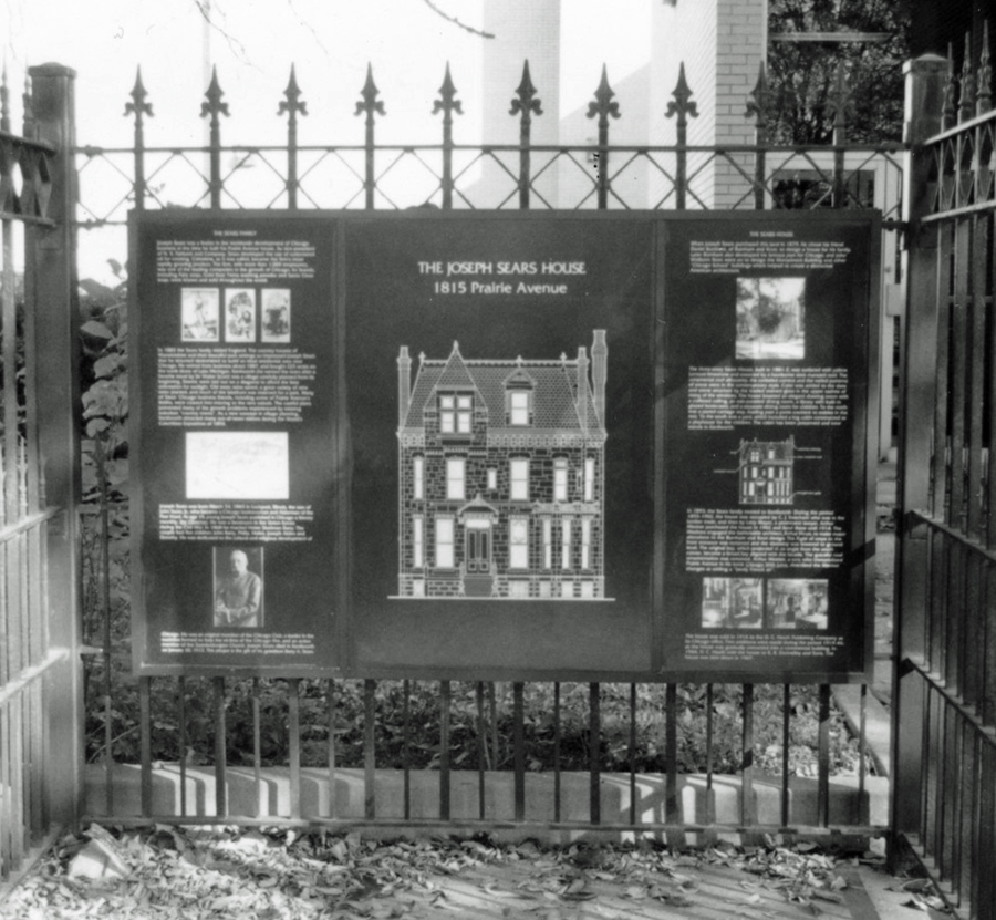
Two smaller pieces of the plan were instituted during the 1980s. A series of interpretive panels showcasing the houses along Prairie Avenue had been under development since the fences were erected along the street in 1978. During the summer of 1982, the first nine panels were installed in the fence alcoves and in front of surviving houses and the site of lost houses on the east side of Prairie. Each panel featured a rendering of the house, information on the family that built it, and their contributions to the business and cultural growth of the city. Five more panels were added later.


Interpretive panel for the Joseph Sears house at 1815 S. Prairie Avenue

In May 1987, the bronze sculpture commemorating the Battle of Fort Dearborn (at the time still referred to as the “Fort Dearborn Massacre”) was returned to the neighborhood and placed in the park to the south of Glessner House. The sculpture, erected by George Pullman in 1893 on his property at 1729 S. Prairie Avenue, had been removed in the early 1930s after it was vandalized. It was owned and displayed by the Chicago Historical Society for many years, before being deeded to the city in 1986, making its return to the area possible.


Neighborhood tourees take a break in front of the Battle statue, circa 1990

In 1989, after plans to host the World’s Fair were abandoned, there was renewed interest in moving forward with plans for the park. Landscape architect Michele McBride was engaged to prepare an updated master plan with a total price tag of $600,000. Major components included period gardens around Clarke house, such as the family might have tended during its period of occupancy, and a meadow area with grasses and wildflowers that would convey the character of a native prairie.


Park plan prepared by Michele McBride, 1989

The Prairie Avenue side of the park was envisioned as more of a true park with large open lawns dotted with trees. The outlines of the original houses would be defined in stone and would relate directly to the interpretive signage set into the fence alcoves along the street. A meandering path would move in and out of the “houses.”

Federal Building Fragments

As was the case with earlier plans, it was never acted upon and the park remained undeveloped. Gerald R. Wolfe, in his book, Chicago In and Around the Loop, noted the park with its few architectural fragments “creating the impression of an old cemetery, which in effect it is, with the scattered chunks of stone as memorials to the once proud houses.”

The granite fragments were pieces of two 45-foot-tall Corinthian columns that had originally supported the dome of the Federal Building designed by Henry Ives Cobb. They were salvaged when the building was demolished in 1965, but by the early 1980s they had been thrown into Lake Michigan to reinforce a breakwater. Being rescued once again, they were moved to the park on Prairie Avenue where they remained until being reassembled in 1996 to form the gateway into the Richard and Annette Bloch Cancer Survivors Garden in the northeast corner of what is now Maggie Daley Park. With the removal of these columns from Prairie Avenue, the idea of an architectural fragment park was permanently put to rest.


Federal Building columns as installed at the Cancer Survivors Garden

In our next installment, we will examine a period of great activity for the park in the late 1990s that coincided with the redevelopment of the surrounding neighborhood as a highly desirable residential community for the first time in almost 100 years.

Tuesday, March 16, 2021

The Chicago Women's Park and Gardens - Part I

The Chicago Women’s Park and Gardens, located immediately south and west of Glessner House, was created to honor important women in the city’s history. To commemorate Women’s History Month, we begin a three-part series exploring the history of the park and the women that it honors. In Part I, we will reveal what originally stood on the site, with a particular focus on the development and decline of Indiana Avenue.


The map shown above captures the block, which presently contains the park, as it appeared in 1911. Prairie Avenue is on the right (east), Indiana Avenue on the left, 18th Street at the top, and 20th Street, now Cullerton, at the bottom. The site of the park and fieldhouse is outlined in red. The two buildings shown in green – Glessner House and Keith House, are the only two buildings that still stand today. Buildings shown in yellow were still standing in 1950, but all had disappeared by the 1980s.

The fact that the park is split roughly in half between properties that faced Prairie and Indiana provides an opportunity to discuss the dramatic difference between the development of the two avenues. In the late 19th century, Prairie Avenue emerged as Chicago’s most exclusive residential street - the “sunny street of the sifted few” as it was then known. Approximately 90 mansions lined the six blocks of Prairie Avenue between 16th and 22nd streets. Six of those spacious homes stood on the land where the park is today. Those homes were designed by the most prominent Chicago architects of the day, including Burnham & Root, Cobb & Frost, and John Van Osdel. Residents included O. R. Keith, George Wheeler, Charles Henderson, Charles Schwartz, Daniel Shipman, and Fernando Jones – all millionaire business owners who helped Chicago evolve into a world-class city in the decades following the Great Chicago Fire.


1800 block of Prairie Avenue looking southwest; Glessner House at right. Photo by George Glessner, circa 1888.

Indiana Avenue, although just one block west of Prairie Avenue, never achieved the same status. On the map, you can see the outline of fourteen houses facing Indiana that stood within the present park. One additional house, at the south end of the park site, does not show as it had already been torn down. Three additional rowhouses faced 18th Street, squeezed into lots that encroached upon the back yards of the homes at the corner. All of these homes were much more modest in size, and little is known of them, as their construction rarely warranted attention in the newspapers.


Rowhouses at 213-217 E. 18th Street; the site is now occupied by the patio for the Spoke & Bird restaurant. Photo by Richard Nickel, late 1960s.

Why was Indiana Avenue so different? The answer is simple – from its earliest days, well before the Fire, the street served as an important transportation route through the south side. A horse railway line traveled south on State Street from Lake Street, turned east on 18th Street, and then south on Indiana Avenue, running as far as 31st Street. By the time streetcars were introduced, the line had been extended to 51st Street, where it then turned east, and continued to South Park Avenue (now King Drive), ending at the northwest corner of Washington Park. The streetcar line was discontinued in May 1953.


Southbound Indiana Avenue streetcar approaching 20th Street (now Cullerton Street), 1925.

The entire neighborhood around the site of the Women’s Park began to decline in the first decades of the 20th century. The causes were numerous – its location close to downtown, the encroachment of industry, increased noise and pollution, and nearby nuisances including the “Levee” red light district. Indiana Avenue, with its more modest homes and convenient transportation, was impacted first. This can be seen on the 1911 map. At the south end, near 20th Street, two houses have already been replaced by a store and a post office, two others have been converted into a cigar factory, and one of the larger coach houses was occupied by peddlers. No such intrusions can yet be seen on Prairie Avenue.

The biggest change to Indiana Avenue took place in the late 1920s. In response to the rapid growth of the city in the preceding decades, planners decided to widen certain streets heading in all directions from downtown, establishing major arterial streets to handle increased motor traffic. Indiana Avenue, with its streetcar line already in place, was identified as a major thoroughfare heading south. The decision was made to increase its width from 66 to 100 feet by taking 34 feet from the lots along the east (park) side of the street. The plan was temporarily delayed with a suit filed by Eastman Kodak, which in 1905 had built a large plant right up to the lot line at the northeast corner of Indiana Avenue and 18th Street. Eventually, it was forced to sell the needed 34 feet to the city, chopped off the east part of its building and constructed a new façade. (A close examination of the building today shows the difference between the 1905 18th Street and the 1927 Indiana Avenue facades.)

By the late 1920s, the buildings on Indiana that stood where the park is today were run down houses, most having been converted to business use or boarding houses. As such, most were simply torn down when the street was widened. The photo below, an aerial shot taken from the tower of the R. R. Donnelley building in 1935, shows the park site and the general condition of the neighborhood at the time. Note the many vacant lots along Indiana with only scattered coach houses still in place, which could function independently for small business use.


 The first comprehensive zoning ordinance was passed by the city in 1923. The entire neighborhood was not zoned residential, but for business and manufacturing. When new buildings were constructed on the east side of Indiana Avenue, they were built for these purposes. A modest two-story brick building (shown below) was constructed at 1901-1903 S. Indiana Avenue and through the years housed a variety of auto-related businesses, to compliment the automobile showrooms that lined Michigan Avenue one block to the west. It was torn down in the 1980s, its last years spent housing the “Coach House Livery” which operated horse and carriage rides on North Michigan Avenue.


1901-1903 S. Indiana Avenue. Photo by Richard Nickel, late 1960s.

The present park fieldhouse (shown below) was completed in 1928 at the southeast corner of Indiana Avenue and 18th Street, occupying lots originally containing five houses. The architects were Hyland & Corse, a partnership of Paul V. Hyland and Redmond P. Corse. As originally designed, it contained several storefronts which housed the Indiana Restaurant and various shops; doorways faced both 18th Street and Indiana Avenue. Most of the building was used for manufacturing. Gus Manos started leasing the building just a few years after it was built and purchased it in the 1940s. For decades, he operated a company which became known as Swiss Products, pioneering the development of dehydrated gravies, soup bases, and flavor boosters for use in the restaurant business. (The company survives today at 4333 W. Division Street).


Swiss Products building, 1801-1811 S. Indiana Avenue. Photo by Richard Nickel, late 1960s.

Famed architectural photographer Richard Nickel was instrumental in saving Glessner House in the 1960s. At that time, he also documented the neighborhood around the house, providing a rare glimpse of the future park site as it appeared at its low point – vacant lots or parking lots to accommodate the surrounding businesses. This article closes with several of those views. In the next installment, we will look at the initial concept for the creation of a park in the early 1970s.


Aerial view looking northeast, Glessner House at upper center.


Looking northwest on Prairie Avenue, Glessner House at right.


Looking south toward the Keith House, 1900 S. Prairie Avenue.


Looking south toward 1901-1903 S. Indiana Avenue; this is the current site of the Clarke House Museum.


Looking north toward the Swiss Products building, 1801-1811 S. Indiana Avenue; this is now the park fieldhouse.


Surviving coach houses from 1813 and 1815 S. Indiana Avenue adjacent to the Swiss Products building. These were demolished in the 1970s.


Looking northeast toward Glessner House. The brick alley ran from 18th Street south to Cullerton Street. A portion still remains behind Glessner House.


When the alley was removed for the creation of the park, the bricks were salvaged and reused to edge the gravel paths.

Tuesday, February 2, 2021

Chicago's Forgotten World's Fair: The American Negro Exposition of 1940

February is Black History Month. The observance goes back to 1926, when the Association for the Study of African American Life and History launched Negro History Week. It took place during the second week of February to coincide with the birthdays of Abraham Lincoln and Frederick Douglass. By the late 1960s, it has evolved into Black History Month, and in 1976 it was officially recognized by the U.S. government for the first time by President Gerald Ford. 


In this article, we are going to explore the history of Chicago’s “forgotten” World’s Fair – the American Negro Exposition of 1940, which took place at the Chicago Coliseum, located just a few blocks from Glessner House, at Wabash Avenue and 15th Street. The event only ran for two months, but took years to plan, and received the endorsement of officials ranging from Mayor Edward J. Kelly of Chicago, all the way up to President Franklin Delano Roosevelt.


The 1933 Chicago World’s Fair

There was interest in an exhibition noting the accomplishments of African Americans at the 1933 Century of Progress World’s Fair, but the plans never materialized. An exhibition, known as the African and American Negro Exposition, did come together, but it was held two miles from the fairgrounds in the Pythian Temple at 3737 S. State Street, in the heart of Chicago’s Bronzeville community. The site of that Negro Exposition was significant, as the Temple, designed in 1927 by African American architect Walter Thomas Bailey, was promoted as the “largest building financed, designed, and built by black people.” However, its distance from the fairgrounds failed to attract a worldwide audience, with attendees coming mostly from the local black community. (The Temple was razed in 1980). 


Planning for the “Black World’s Fair”

Planning for a much larger fair began in December 1934, just a few months after the Century of Progress closed its second year of operation. In that month, the United Cooperative League of America, Inc. was organized in Chicago, with real estate businessman James W. Washington as founder and first president. Over the next five years, Washington was said to have traveled more than 135,000 miles securing endorsements for what he originally called the “Afra-Merican Emancipation Exposition” to be held in 1940, the 75th anniversary of the emancipation of the slaves at the close of the Civil War. He secured the rental of the Coliseum for $22,500 on his own signature and reputation, and later received an appropriation from the State of Illinois for $75,000 ($1.4 million today) which was later matched by the U.S. Congress.

The headquarters for the Exposition was 3632 South Parkway (the present address would be 3632 S. King Drive although the building no longer stands). This was an important address in the black community as the former three-story stone mansion had been home to the Appomattox Club since 1920. The Club, a social and civic organization, was one of the most important gathering spots in the city for its black business and political leaders.  (It closed in the late 1960s).


Washington promoted the Exposition as “the first real NEGRO WORLD’S FAIR in all history” and noted that its objective was to “promote racial understanding and good will; enlighten the world on the contributions of the Negro to civilization and make the Negro conscious of his dramatic progress since emancipation.”

Washington served as president and engaged a young attorney, Truman K. Gibson, Jr., to serve as executive director. The members of the U.S. Auxiliary Committee were personally selected by President Roosevelt and hundreds of endorsements were received, including the American Federation of Labor, the Federal Council of Churches of Christ in America, and the National Red Caps Association (a union of railroad porters and other employees).

Opening of the Exposition


Chicago Tribune, July 5, 1940

The Exposition officially opened on July 4, 1940 when President Roosevelt pressed a button in his Hyde Park, New York home to turn on the lights. The keynote speaker was Mayor Kelly who noted, in part:

“The nation pays a debt of gratitude to the Negroes today. Not alone for their contributions to the arts and sciences, not alone to the good and great names that stand out in the book of American achievement, but to the great mass of 14 million Negroes who help to form the backbone of American democracy.

“They deserve the good life, because in the greater part, they choose to be the good citizens. They deserve the rewards of democracy because they appreciate so well the blessings of liberty. They have given much, and they are entitled to much.”


The other principal speaker was Senator James M. Slattery, who had introduced the bill in the U.S. Senate calling for the $75,000 appropriation for the Exposition. He noted: 

“In this hour we need for all Americans the intense patriotic devotion of the American Negro. In the hour of peril, the American Negro has never failed his country. He will not fail it now. You may spell Afro-American with a hyphen if you will; but there is no hyphen in the Negro’s allegiance to America.”


Tickets cost 25 cents (about $6.50 today) and provided attendees access to over 120 exhibits highlighting the artistic, cultural, industrial, and scientific achievements of the Negro throughout history. Exhibition participants include the major departments of the U.S. government, Tuskegee Institute and Howard University, the Association for Study of Negro Life and History, over 230 Negro newspapers, and companies such as the Columbia Recording Company, Chrysler, Pepsi-Cola, and Firestone Rubber Co. (which funded the Liberia exhibit).

Court of Dioramas


The centerpiece of the Exposition’s main hall was the Court of Dioramas, containing thirty-three dioramas, each five feet wide, created to “illustrate the Negro’s large and valuable contributions to the progress of America and the world.” Crafted of plaster, wood, and Masonite by African Americans, the subject and design of each was overseen by Charles C. Dawson, a graduate of Tuskegee Institute. Subjects ranged from the building of the Sphinx and Ethiopians using the first wheel to Crispus Attucks (the first casualty of the American Revolution) and Matt Henson accompanying Admiral Peary to the North Pole.  The Court was centered with a huge model of Lincoln’s Tomb and Monument in Springfield, Illinois. 


Surrounding the Court was a series of twenty murals by the talented African American artist William Edouard Scott, a graduate of the School of the Art Institute. Scott was one of the first to depict the “New Negro” in an uplifting way by breaking away from the subjugating images of the past. The subjects of his murals ranged from Chicago’s first permanent settler – Jean Baptiste Point du Sable – trading with the Indians, to Marian Anderson singing the Star-Spangled Banner at the Lincoln Memorial in Washington, D.C.


Tanner Hall

The south hall of the Coliseum contained Tanner Hall, displaying 300 paintings and sculptures and billed as “the greatest collection of Negro art ever assembled.” It was named in honor of artist Henry O. Tanner (1859-1937), regarded as the preeminent Negro artist of his time, and the first to receive international acclaim. Ten of his paintings were displayed.


Also on display in the Hall was the limestone sculpture “Negro Mother and Child” by the African American and Mexican artist Elizabeth Catlett. Completed as her master’s thesis, the artwork won first place at the Exposition.


Other Highlights

The Hall of Fame honored thirty-one outstanding Negroes and their contributions to art, entertainment, literature, industry, and science. Most were depicted in portraits by Persian artist Salvatore Salla. Among those honored in the Hall of Fame were women’s leader Mary McLeod Bethune, labor leader A. Phillip Randolph, athlete Jesse Owens, and architect Paul R. Williams (at the time, the only Negro member of the American Institute of Architects).

Live entertainment could be enjoyed both in the intimate cabaret located above Tanner Hall, and in the immense theatre in the north hall, which sat 4,000 people. Arna Bontemps and Langston Hughes co-wrote “Jubilee: Cavalcade of the Negro” a musical commissioned for the Exposition. Other productions included “Tropics After Dark” and a swing version of “Chimes of Normandy,” a popular French opera. Performers included Duke Ellington, baritone Paul Robeson, and dozens of dancers and choruses. Motion pictures, ranging from entertaining to educational, were screened regularly and included “The Negro in Education” produced by the Rockefeller Foundation.

Literature was another focus and a special book, entitled Cavalcade of the American Negro, was produced by the Illinois Writers’ Project. 


Poet Margaret Walker, who became a prominent member of Chicago’s Black Renaissance, contributed a poem which began:

“Come now my brothers and citizens of America
and hear the strange singing of me, your brother,
and see the strange dancing of me, your daughter,
and know that I am you and you are me
and the two are as one in danger and in peace,
in plenty and in poverty,
in freedom forever,
in power, and glory and triumph.” 

Every day of the Exposition was designated for a specific state, organization, or theme. Sundays were given over to various Christian denominations from Baptist to Catholic.   

On August 21, the Du Sable Memorial Society gave a program honoring Chicago’s first permanent settler. A replica of his cabin, originally made for the 1933-1934 World’s Fair, was reconstructed. The program opened with the signing of “Lift Every Voice and Sing,” noted as the “Negro national anthem,” and featured State Representative Charles Jenkins as the main speaker. (Jenkins had introduced the bill resulting in the $75,000 state appropriation for the Exposition).


The Chicago Defender, Chicago’s leading African American newspaper, sponsored a beauty contest to select Miss Bronze America. The winner, 19-year-old Miriam Ali, used her $300 prize to pay for her tuition at the Illinois State Normal College.


Chicago Defender, September 7, 1940

Closing of the Exposition

The Exposition closed on September 2, 1940 with an elaborate program featuring the Democratic nominee for Vice President, Henry A. Wallace, as the keynote speaker (he promised a non-political speech and was elected Vice President two months later). Entertainment including the J. Wesley Jones chorus of 1,000 and selections by Paul Robeson. Organizers had hoped two million people would visit the Exposition, but the exact number of attendees is unknown.

After the Exposition

1940 – Although the Exposition promised to demonstrate great progress for the Negro, with support and cooperation from elected officials, major hurdles remained. On December 31, 1940, less than four months after the Exposition closed, a restrictive covenant went into effect covering the entire neighborhood around the Coliseum, from Roosevelt on the north to Cermak on the south, and State on the west to Lake Michigan on the east. The covenant made residency by anyone possessing 1/8 or more Negro blood illegal. The covenant was to run for twenty years but was nullified in 1948 when the U.S. Supreme Court outlawed restrictive covenants.

1944 – James W. Washington, the “Father of the Exposition,” died unexpectedly. After the close of the Exposition, he formed the American Boystown Corporation to construct Boy’s Town, a home and school near Momence, Illinois, to care for and train underprivileged boys of all races and creeds (like the more famous Boy’s Town in Nebraska). Construction was about to begin at the time of his death.

2005 – Truman K. Gibson, Jr., an attorney, and the executive director of the Exposition, died at the age of 93. Gibson is regarded as one of the unsung heroes of the Civil Rights Movement and served on the “Black Cabinet” of Presidents Roosevelt and Truman. The Black Cabinet was a group of African Americans first assembled by Roosevelt in 1933 to serve as public policy advisors.   

2020 – CBS Sunday Morning produced a segment on the conservation of the twenty surviving dioramas from the Exposition, which were acquired by Tuskegee University. The conservation work, begun in 2018 under the direction of Tuskegee’s Legacy Museum curator Dr. Jontyle Robinson, had an unexpected impact. Aware of the fact that less the two percent of conservators in the U.S. were African American, she helped to attract students to the field to work on the dioramas. 

Watch the original six-minute CBS Sunday Morning segment, which aired on August 30, here, and be introduced to LaStarsha McGarity (shown above), now an Andrew W. Mellon Fellow in Objects Conservation with the National Gallery of Art in Washington, D.C. due to her work in restoring a diorama.


Related Posts Plugin for WordPress, Blogger...